Wednesday, January 16, 2013

SOUVENIR DECAL OF BAGNELL DAM

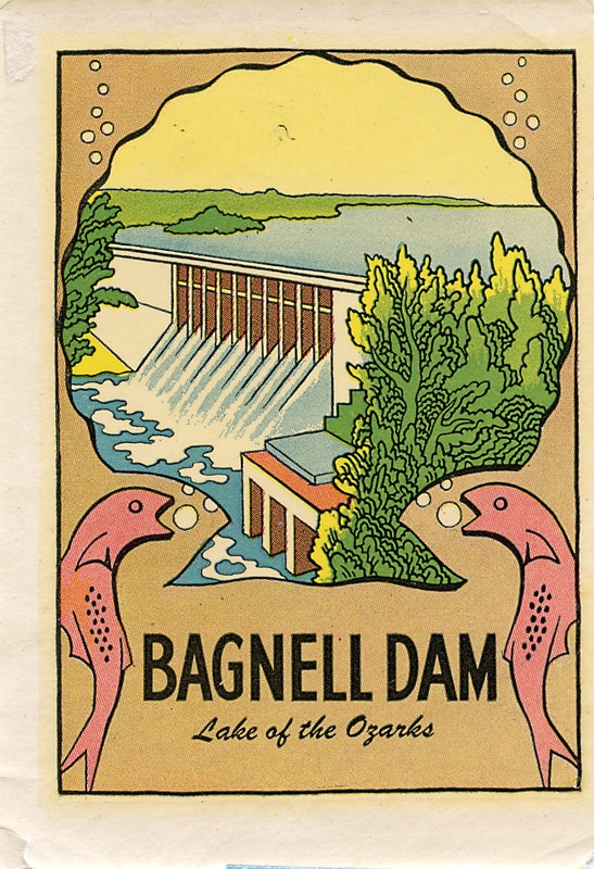
Decal Bagnell DamWater-based Decal, 1950s

Water dip decals are colorful cartoonish icons of vintage vacations. They decorated luggage and car windows, commemorating many a family vacation at Niagara Falls, a visit to a buffalo ranch, or Disneyland. Hobbyists have for generations used decals on car and airplane models.

Flanked by a couple of pink fish, this colorful unused decal is likely a souvenir of a weekend at The Lake. Popular imagery of Bagnell Dam rivaled pictorial representations of Boulder/Hoover Dam in both variety and abundance.


Every week we post an unpublished image that relates to the Osage River, its ecology, history and development. None of these have been used in Damming the Osage, but they relate to the themes of the book. A brief caption identifies the location and our thoughts on its significance and meaning. Feel free to use these images for personal use if you credit “Collection of Leland and Crystal Payton.”  For commercial use, email us for details and a modest fee for a higher resolution image. We have thousands of historic photographs and brochures as well as our own contemporary photos.

If you have comments or additional information on these images please use the form below.

If you would like to receive email notifications of the Vintage Image of the Week, please provide us with your email.


SOUVENIR DECAL OF BAGNELL DAM

Wednesday, January 9, 2013

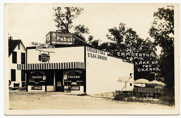
NIGHT HAWKS TAVERN, Camdenton, Missouri

Real photo postcard, 1935-1945

Inscription on back reads – “We enjoyed a fine meal here today with Toots and Jack.”

Toots and Jack Stotler operated this thriving business from 1933 until selling to Buford and Anna May Foster in 1945. The Fosters changed the name to Night Hawk Café. A stunning large neon sign with a flying night hawk whose neon wings flapped hung over the sidewalk.  The parents of Leland Payton, senior author of Damming the Osage, went on dates to the Night Hawk, driving in from Versailles. Highway engineer Louis Payton rented a room in Versailles and met Ann Lewis Daniels at the Baptist Church.


Every week we post an unpublished image that relates to the Osage River, its ecology, history and development. None of these have been used in Damming the Osage, but they relate to the themes of the book. A brief caption identifies the location and our thoughts on its significance and meaning. Feel free to use these images for personal use if you credit “Collection of Leland and Crystal Payton.”  For commercial use, email us for details and a modest fee for a higher resolution image. We have thousands of historic photographs and brochures as well as our own contemporary photos.

If you have comments or additional information on these images please use the form below.

If you would like to receive email notifications of the Vintage Image of the Week, please provide us with your email.


NIGHT HAWKS TAVERN, Camdenton, Missouri

Sunday, October 14, 2012

OSAGE RIVER and the Missouri State Capitol

The Osage River runs a course of about 500 miles from the Flint Hills of north central Kansas to Bonnot’s Mill in central Missouri where it joins the Missouri River. A fecundate prairie stream that cuts into the Ozark uplift in mid-Missouri, the Osage is rich with human history.  One little remembered piece of history involves the site selection for the state’s capitol of governance.

Why is Jefferson City, a modest town in central part of the state on a bluff overlooking the Missouri River, the capitol of Missouri? Why not a larger, more commercial, more populated urban setting?


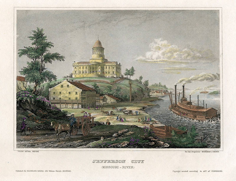
Steel engraving of Missouri’s second capitol from an 1852 Meyers’ Universum, published in Germany. (and page 292, Damming the Osage)

The answer to that question is found in the 1820 constitution of the soon-to-be-state of Missouri.  At that time, rivers were the highways of the frontier—rutted lanes were the closest thing to a surface road and they were scarce; railroads were not even a gleam in a developer’s eye.  Waterways carried the freight and passengers pushing west.  Rivers were “…common highways, and forever free to the citizens of this state and of the United States, without any tax, duty, impost, or toll, therefor, imposed by the state.”

The Mississippi and Missouri were the continental pathways; the tributary Osage carried fur traders to their Indian suppliers, and later carried steamboats with settlers and supplies to communities established along its banks. Under Article X, “Of the Permanent Seat of Government”, the General Assembly was directed to name five commissioners from different part of the state to select a site for the state capitol. The primary limitation for selection was “that no place shall be selected which is not situated on the bank of the Missouri river, and within forty miles of the mouth of the river Osage.”


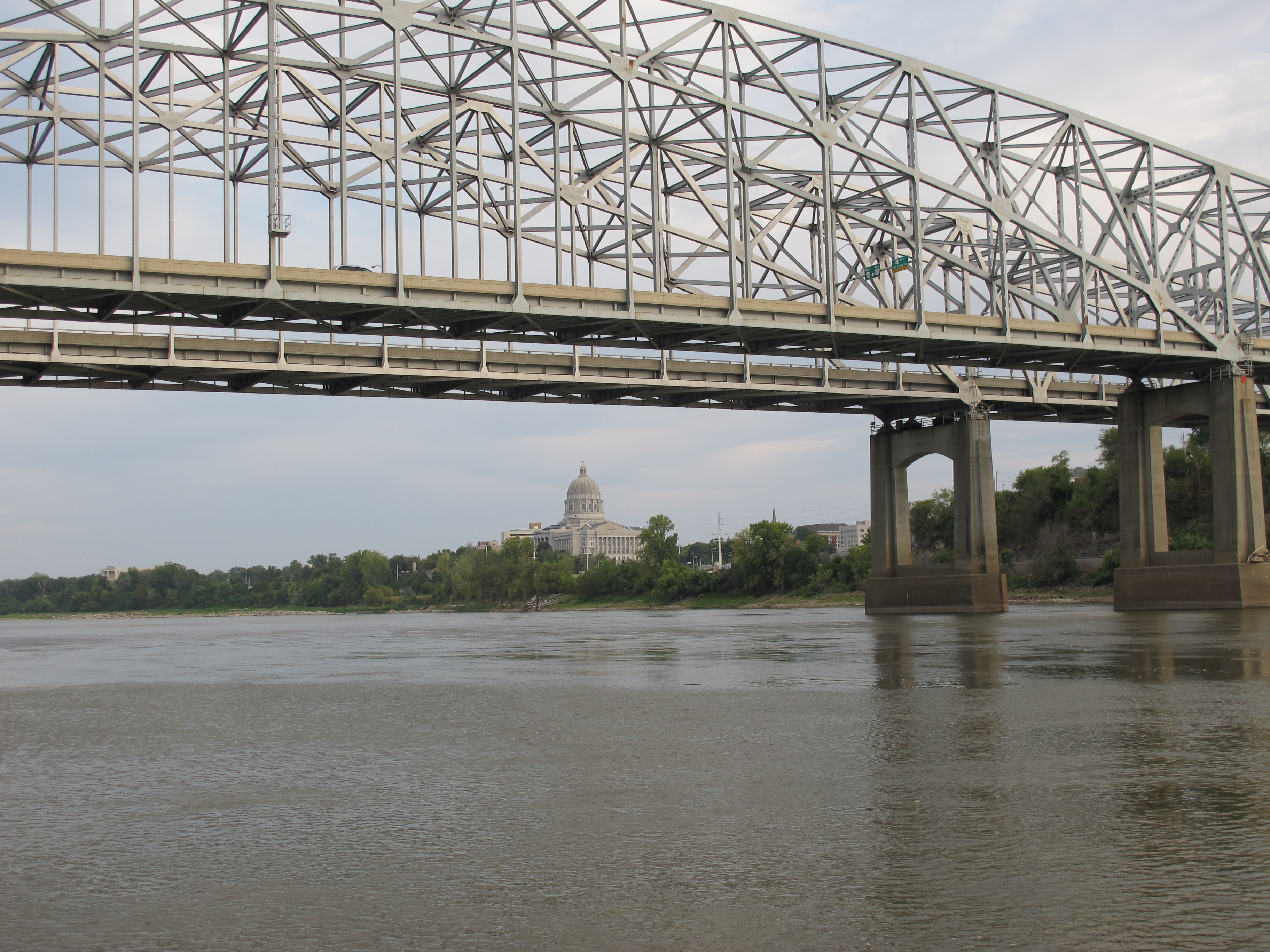
US Highways 63 and 54 cross the Missouri River at Jefferson City, just west of the capitol.

First railroads, then highways co-opted commercial river transportation.

The Osage at times runs a large quantity of water. Its access to western Missouri would have made it a good conduit not only to western Missouri and eastern Kansas, but an avenue to a jumping-off place for overland travel to Santa Fe and the southwest.

Missouri’s capitol, named for Thomas Jefferson, only 18 (more or less) miles from the original mouth of the Osage, was incorporated in 1821.

Although the Osage Indians and French fur traders and early American officials knew it was seasonally unreliable for boat travel (from canoes to steamboats), business interests ignored its hydrologic realities and pushed for river improvements. Before the Corps of Engineers spent hundreds of millions of dollars on multipurpose dams of questionable usefulness in the Osage valley, they wasted hundreds of thousands of dollars on “improving” the Osage for steamboat travel.


OSAGE RIVER and the Missouri State Capitol

Sunday, September 30, 2012

YouTube channel for Lens & Pen

As the publication date approaches for our newest book - DAMMING THE OSAGE: The Conflicted Story of lake of the Ozarks and Truman Reservoir - we're producing and posting new videos to the Lens & Pen YouTube channel ... take a look!

This has inspired us as well to renew the stories of the Irish Wilderness, tourism in the Ozarks and Leland's own vision of the Beautiful and Enduring Ozarks. Watch for videos on these subjects as Lens & Pen celebrates this remarkable region.


Friday, September 28, 2012

Jacks Fork and Current Rivers - and the Irish Wilderness


The Jack's Fork River (on the left) flows into the Current, marked by a stream of blue in the Current's channel. These National Scenic Rivers are favorites of floaters, but this early fall Sunday afternoon, canoe traffic was light. We were visiting some of the sites Father John Joseph Hogan spoke of in his memoirs of life as a frontier priest before the Civil War. From Mystery of the Irish Wilderness:

On Hogan's second trip to the Ozarks in late November, 1857, he was accompanied by Father James Fox. They forded the Current River on horseback at this spot where the Current's principal tributary, the Jacks Fork River, enters.

Wednesday, September 26, 2012

DEATH OF THE SCHELL CITY BRIDGE

Just north and west of Schell City, Missouri, down the old “River Road” are the ruins of an iron truss bridge that for a hundred years spanned the Osage River, connecting Schell City and Rockville. It’s not far from where the Bates County Ditch (which has its own interesting and little known history) enters the Osage. Closed traffic for many years, it fell into the river in February of this year. Sadly each year there are fewer and fewer of these wonderful iron truss bridges. The usual cause of their demise is obsolescence and lack of maintenance. They are replaced by architecturally uninteresting steel and concrete girder bridges. This 317 foot iron bridge became structurally deficient when maintenance stopped.

We have posted here on our website and on YouTube a video tribute and mini history of this iron bridge.


Wednesday, August 29, 2012

EXPOSED! Lock & Dam #1 on Osage


This summer’s drought has drastically lowered water levels on major waterways throughout the. Midwest. The Corps of Engineers first major water control project on the Osage – built around the turn of the last century to facilitate steamboat travel – it was if anything an impediment to river commerce. This morning the crumbling hulk lay exposed to sun and camera…. A reminder that water resource projects have a finite usefulness and then become relics and dangerous ruins.