Showing posts with label Current River. Show all posts

Saturday, November 15, 2014

November 15, 1857 - FATHER HOGAN'S SECOND EXPLORATORY TRIP TO THE OZARKS

-->
This time Hogan's companion on the trail was his mentor and dear friend, Father James Fox, pastor of St. Joachim's church in Old Mines. Hogan was apparently excited by the settlement opportunities he had seen on his first swing through the eastern Ozarks. According to parish records, he returned to Chillicothe October 15 and a month later (Nov. 15) he was headed south once again to ride deeper into the much more affordable real estate of the Ozarks.

Father Fox, a native of County Wicklow, Ireland, shared Hogan’s concern for the waves of arriving poor immigrants who could not afford to establish themselves in this new land, with land or homes or businesses. For three weeks they rode through southeast Missouri.  That they both came from rural backgrounds, with knowledge of agriculture and the kind of land needed to support a farming operation was an invaluable asset in their evaluation of the terrain.


MY DEAR FRIEND FATHER FOX
 Arrived at Chillicothe, I corresponded without delay, with my dear friend and worthy brother priest, Rev. James Fox, rector of St. Joachim's church, Old Mines, Missouri, who as I well knew, was deeply concerned for the matter of land ownership and occupancy by Catholic emigrants. The incidents of my late journey, which I related to him, so interested him that he requested to be permitted to accompany me on another such journey, if I should have occasion to make one. I wrote to him to be ready and that I would soon call on him.

        Before many days, and in the latter part of November, we set out together on horseback from Old Mines. Traveling by way of Caledonia and Edgehill, we passed through Centerville the county seat of Reynolds County. Thence entering Shannon County, we descended Blair Creek, remarkable for its alternate limestone and red porphyry hills. Afterwards, we crossed the Current River at the mouth of Jack's Fork,


The Jack's Fork River (on left) flows into the Current. Close to this spot, Hogan and Fox forded the Current in 1857 on their November trip to explore possible sites for a settlement in the Ozarks

thence to Eminence, thence to Birch Tree, thence to Thomasville, thence to Pike Creek, thence to Van Buren, thence to Ten Mile Creek, thence to Black River, thence by way of Otter Creek, McKenzie Creek and Big Creek, through Caledonia and Potosi, homeward. Reynolds County we found entirely unfit for settlement, not one tenth of the land being tillable. Shannon and Oregon counties had much tillable land, perhaps one-third of the whole area, but none of it of prime quality except the river alluvial bottoms. Everywhere through these two last named counties, there was good stock range and abundance of valuable pine forest.

Thomasville in Oregon County is situated in this broad alluvial valley along the Eleven Point River.  

Both Hogan and Fox brought to bear their complete grasp of agricultural and industrial technologies and supremely practical analysis of the opportunities and limitations available.  Hogan definitely intended this settlement to succeed.

SPECIAL PRICES: Mystery of the Irish Wilderness is now $16.95 (regularly $18.95), postpaid: and On the Mission in Missouri and Fifty Years Ago: A Memoir is $18.95 (regularly $24.95), postpaid.



Thursday, October 9, 2014

HOGAN’S FIRST EXPLORATORY TRIP TO THE MISSOURI OZARKS – September 24 to October 15, 1857

About this time of year, in the early autumn of 1857, John Joseph Hogan left Chillicothe to survey the cheaper, government land available for purchase in the Ozarks. Look at a road map today and you’ll realize that there still is not an easy way to cover those 400-plus miles from his chosen mission in Chillicothe to southeast Missouri.  Still he was determined:
 
It seemed to me to be my duty to do whatever might be in my power, to aid these people to rise from their condition of servitude, to ownership and cultivation of land, so as to secure for them, beyond doubt, a settled and permanent mode of existence, that would accord better with their higher social aspirations and religious principles. This, however, could not be done in North Missouri, where land was held at too high a price. 

Hogan wasn’t one to plunge off without a plan.  He had procured plots and surveys of available government lands in the Ozarks and knew where he was going. The itinerary he lists in his memoir (On the Mission in Missouri: 1857-1868) of his first trip southward is short, but it would have been an arduous journey by steamboat on the Missouri River to St. Louis, then train to Iron Mountain or Frederick Town, then by horseback into the hills and over rivers for several weeks. 

SURVEYING
Traveling by way of Brunswick, Jefferson City, St. Louis, Old Mines, Potosi, Iron Mountain and Frederick Town, I halted at Greenville, in Wayne County, where I hired a surveyor familiar with the country. I examined the lands on the head waters of Little Black River, Cane Creek, Brushy Creek, in Ripley (now Carter) county, and entered four hundred and eighty acres in a body on Ten Mile Creek, making arrangements at once to put men thereon, opening and cultivating it. 
With the surveyor I rode westward, across the Current River, by Van Buren, up Pike Creek, thence southward over the great divide east of Eleven Points River as far as the head waters of Buffalo Creek, thence eastward along Buffalo Creek and its tributaries to a ford on Current River. At this place there was a mill and homestead owned and occupied by a man named Appollinaris Tucker; he and his family were the only Catholics known to be residing at that time in that district. At the time of my arrival, Mrs. Tucker was in the last stages of her mortal illness, in which it seemed God's Holy Will that she should linger until her longings could be gratified to receive the last Sacraments; and, as it happened, from the hands, of the first priest known to have come into that region of country. After Mrs. Tucker’s death, I returned homewards, by way of Iron Mountain, St. Louis, and Hannibal, to Chillicothe.
Appollinaris and Ellen Tucker purchased government land in 1854 and 1856 in Ripley County. There is no record of the mill after the Civil War or of what became of Appollinaris Tucker.


Tucker Bay Spring, with 24 million gallons a day, is #18 on the list of Missouri's 20 largest springs. A Google search brings up little information and few pictures.  It's located on Forest Service land in the Mark Twain National Forest in Ripley County and the site is difficult to get to. The spring does not have a dramatic gushing-forth-from-the-rocks beauty like Greer Springs or Big Springs, but rises along the lower one-third mile of an intermittent stream, at the base of a hill, seeming to come from a fault. Other than this account by John Joseph Hogan, there seems to be very little known about it or the people who might have lived by it. Tucker Bay Spring remains one of the mysteries in the region known as the Irish Wilderness.

SPECIAL PRICES: Mystery of the Irish Wilderness is now $16.95 (regularly $18.95), postpaid: and On the Mission in Missouri and Fifty Years Ago: A Memoir is $18.95 (regularly $24.95), postpaid.


Wednesday, September 3, 2014

50 YEARS AGO TODAY THE WILDERNESS ACT SIGNED INTO LAW


Fifty years ago today, on September 3, 1964, President Lyndon B. Johnson signed the Wilderness Act into law after more than sixty drafts and eight years of work. When Johnson signed the act, he made the following statement: "If future generations are to remember us with gratitude rather than contempt, we must leave them a glimpse of the world as it was in the beginning, not just after we got through with it." 


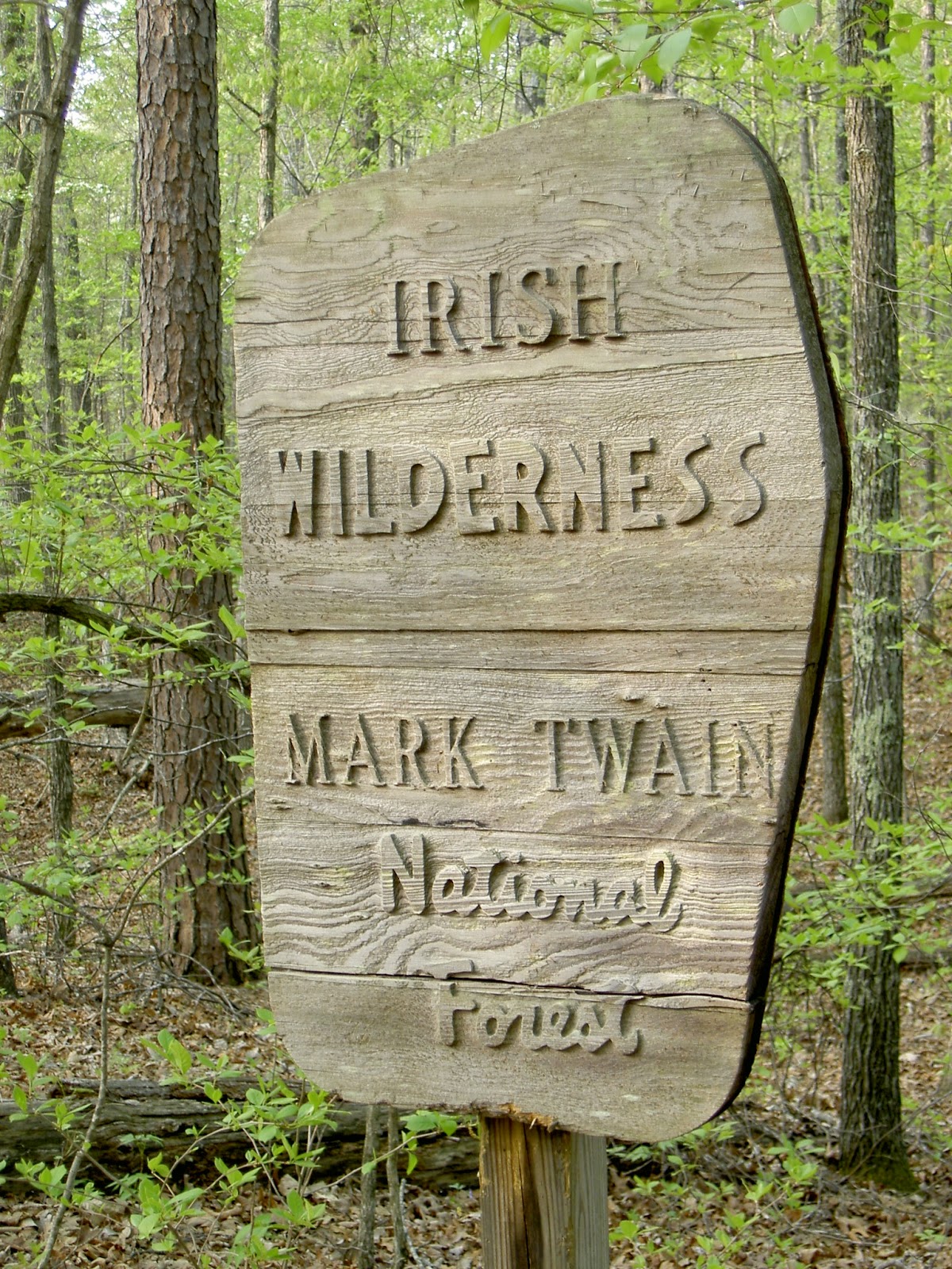
Nearly twenty years later, March 27, 1984, 16,500 acres of rugged, wooded land between the Eleven Point and Current rivers in Oregon and Ripley counties in the Missouri Ozarks were “designated as wilderness and shall be known as the Irish Wilderness.”
 

The inclusion of the area once known as Father Hogan’s Irish Settlement was not done without controversy. Mystery of the Irish Wilderness outlines the competing camps (Sierra Club and environmentalists vs. local landowners) and their arguments that supported or opposed its inclusion. 


See more photos of the Irish Wilderness on our Facebook page:

Saturday, May 24, 2014

WORLD TURTLE DAY - May 23, 2014

Sea turtles, soft shells, red eared sliders, basic box turtles - rare and endangered or common - they are the oldest species of reptile (see Wikipedia on turtles) ... and now they've got their own day!  Granted World Turtle Day was May 23 (yesterday) but that's no reason not to continue the celebration. And it's spring and turtles are on the move ... often in dangerous territory as they try to cross roads, even busy highways, to get to the other side. Drivers, please be aware!

Releasing Appollinaris, our Irish Wilderness turtle, to a safe environment

That is how we found a baby turtle crossing a road when we were in Ripley County researching Mystery of the Irish Wilderness ... In fact we were looking for Tucker Spring where John Joseph Hogan and a surveyor had forded the Current River on his first exploratory trip to the Ozarks in 1857.  His memoir describes a mill at that ford owned by Appollinaris Tucker. Sadly, Mrs. Tucker was on her deathbed:

At this place there was a mill and homestead owned and occupied by a man named Appollinaris Tucker; he and his family were the only Catholics known to be residing at that time in that district. At the time of my arrival, Mrs. Tucker was in the last stages of her mortal illness, in which it seemed God's Holy Will that she should linger until her longings could be gratified to receive the last Sacraments; and, as it happened, from the hands of the first priest known to have come into that region of country. After Mrs. Tucker’s death, I returned homewards, by way of Iron Mountain, St. Louis, and Hannibal, to Chillicothe.
(Mystery of the Irish Wilderness, page 25)

Appollinaris and Ellen Tucker purchased government land in 1854 and 1856 in Ripley County, Missouri. Presumably, Ellen was Mrs. Tucker, to whom Father Hogan administered the Last Rites . . . There is no record of the mill after the Civil War or of what became of Appollinaris. Tucker Bay Spring, a large (24 million gallons a day) but curiously unstudied spring, still flows into the Current River. 

Named in honor of the former mill owner, we let  our Appollinaris grow until large enough to take care of himself and then sent him on his way.

Sunday, January 12, 2014

The Polar Vortex (2014) and an Irish Wilderness winter – 1858


As the Polar Vortex held the country in a deep freeze this past week, NFL wildcard playoffs, college bowl games, Netflix movies, enjoyed in the comfort of central heating, helped pass the time. But my thoughts wandered back to the Irish Wilderness and how difficult life on the frontier must have been in harsh weather circumstances. Images came to mind of a drafty log cabin, with smoke from the fireplace, and temps outside below zero.  So – from a warm office  – I searched the Internet to see what the weather was in Oregon County in November of 1858, when Father Hogan began his almost year-long sojourn there.  
 
While the National Weather Service didn’t seem to have easily accessible records from 150+ years ago, there was another treasure online. The Pope County Arkansas Historical Association had posted the diary of a homesteader’s thousand mile journey from North Carolina to Arkansas by wagon – a journey that took the family across southern Missouri in the early winter of 1858.

This diary of John C. Darr was printed in the Atkins (Arkansas) Chronicle 30 July 1909 through 08 October 1909. The articles were researched and contributed by Mrs. James D. (Earlene) Peak to the Pope County (Arkansas) Historical Association Quarterly. Quarterly Editor: Ms. Laura L. Shull.

The full diary post can be found at http://www.argenweb.net/pope/wagon.html
 
Not surprisingly, the early winter of 1858 was cold, damp and snowy in southeastern Missouri. This traveler’s account gives a less sanguine view than Father Hogan’s of the people and prospects of the area that Irish immigrants were beginning to settle. But it makes one wonder. As they passed through Van Buren and headed west toward Thomasville … were there Irish fellow travelers on the road?

The Darr family crossed the Mississippi River by ferry on November 10 landing near Charleston, Missouri. With other immigrants they traveled from 12 to18 or 20 miles a day. Mr. Darr remarked on places Hogan had also mentioned in his memoir, On the Mission in Missouri: 1857-1868: Black River, Current River, Van Buren, Thomasville, and Howell County.  
18th Nov (1858). Clear, windy and cold. We break up camp with all our company, having caught up with the Sabbath breakers, they having had bad luck by breaking down a wagon. The piously inclined said that it was a judgment meted out to them for traveling on Sunday. We presume that they judged aright; we now pass over some of the poorest and hilliest country I ever saw. Cross Black river, a most beautiful stream of water. Take up camp, having drovn 20 miles, evening clear and cold.

 Johnson Shut-Ins on the Black River.  Photo by Leland Payton, The Beautiful and Enduring Ozarks

Mr. Darr’s take on the local populace is a stark contrast to Hogan’s description of the settlers he met.  In Chapter IX, in the section entitled “Society in Southern Missouri,” Hogan describes “the simple quiet ways of the early settlers of southern Missouri” – from what constituted a respectable dowry to the technology of making clothes and coverlets to a tolerant mention of the daily sips of home brewed liquor. Quite a contrast to those Mr. Darr met and bartered with:
19th Nov (1858). Morning clear and cold. We left camp, winding our way over Poor Pine Ridge, finding here and there small settlements in the coves and valleys which grow such as corn, wheat and the laziest people on earth; as if we wanted to buy corn or potatoes we had to gather and dig them. As to flour and meal we could scarcely buy either, as mills were scarce, sorry affairs and usually unhandy, they did not appear to have the energy to go to mill, or had no use for money. Meat we could always get plenty and cheap, as they got it out of the woods. We next crossed Current river, a good szed stream, rapid and the clearest I ever saw. On its banks stood the village of Van Buren, consisting of half dozen dilapidated old shanties, plenty whiskey, powder and shot. We camp on the banks of the river having drove about 19 miles. 
Leaving Van Buren, heading west, they passed close by the place where Hogan would soon build his log church. A year earlier, in November of 1857, Hogan and his mentor, Father James Fox, had ridden a little farther north through Reynolds and Shannon counties, across the Current River where the Jack’s Fork enters, through Eminence, Birch Tree and on to Thomasville on the Eleven Point River. There they turned back east, going up Pike’s Creek, through Van Buren and Ten Mile Creek, crossing the Black River and on to Potosi and homeward.  

Winter on the Jack's Fork River. Leland Payton photograph, The Beautiful and Enduring Ozarks 

Mr. Darr’s account of the terrain and the village of Thomasville:  

22nd Nov (1858). Snow four inches deep and still snowing. Continue our journey. Ceased snowing at 11 o'clock a.m. Here we came to the valley of Eleven Points river, a small winding stream which we forded on our route 18 times. I, having left the train with my gun shooting small game, had to wade the stream half dozen times before the wagons came up with me. I did not know if I was ahead or behind the wagons until I discovered them behind me. But you must know I had a pleasant time wading the river and six inches snow on the ground. But I had secured a nice bunch of wild pigions which were good and fat, the only fat ones I had ever seen before, although no doubt I had not only seen thousands before but millions, all I killed on our route west of the Mississippi river were fat. Passing up Eleven Points river we camp in the village of Thomasville, a village in the woods. Camp after a days drive of 15 miles, cloudy and snowing again.23rd Nov (1858). Four inches snow on ground this morning. We leave Thomasville, pass through very thinly settled hills and valleys, water very scarce. I must tell you that we had been living on Irish potatoes for several days and still doing so. These we had to dig in the snow; no bread stuff to be had, they would all tell us, "Our folks have gone into Ar-can-saw, about 50 miles to mill with wheat, looking back to-night." (end of quote is my construction) I found some flour for sale in Thomasville. But it being in the night and we had to chase chickens out of their roost in the flour bin, I concluded to wait until morning and stick to the potato digging and eating which was not so bad with fat quail, squirrel and pigeon. Meeting nothing of note we camp in Howells valley after a days travel of 20 miles. Cloudy.
24th Nov (1858). Leave our camp in Howells valley which is a fine prairie country in Oregan county Mo., moving one and one half miles we take the road leading to Yellville, Ark., our way leading over prairie and barren plains, passing many good settlements on the praries.
In a sort of executive summary of findings from his three reconnoitering trips to the Ozarks, Hogan wrote up his keenly observed and knowledgeable conclusions on “The Information Gathered”

The information we had gathered was, that Ripley, Oregon and Howell counties afforded good advantages for settlement to people of small means and of patient, frugal, industrious habits. The country as we found, was quite healthy. Land was cheap. The land was by no means all good, but enough of it was good to support many inhabitants, if not a dense population. About one-third of the whole area could be tilled for orchards, vineyards, or the usual vegetable or cereal crops; and the yield was far more generous than the appearance of the soil would indicate. The ground, too, when once broken and cleared, was easily cultivated. There was plenty of timber of good quality everywhere at hand, that made it an easy task to build dwellings, barns, stables, fences, and to furnish fuel. Springs and streams of pure, clear water were abundant except in a few localities. The lands that could not be cultivated were fairly grassy and could feed many cattle. The price of government land was from twelve and a half cents to one dollar and twenty five cents per acre.


Tuesday, December 3, 2013

IRISH WILDERNESS TAKES SHAPE IN THE OZARKS - 1858 - 1859


November, 1858: For more than a year, John Joseph Hogan with surveyors and friends had scouted  Missouri's southeastern Ozarks for arable land, filed claims for plots through the land agents of Cape Girardeau and found immigrant Irish who would settle the land and work a farm. Near the end of November 1858 – 155 years ago – Hogan again set out for his southern colony.  This fourth trip would be his longest (11 months) sojourn in the Ozarks and the most active months of development of the settlement he envisioned.

Interestingly – and a fact not noted in most official and unofficial histories of his settlement – Hogan did not prefer the deeper Ozarks.  In 1857, on his first reconnaissance trip, he had claimed land in the area around Ellsinore and along the Little Black River (“480 acres in a body on Ten Mile Creek”) finding it more suitable for agriculture and with “improved land enough” that they would not be starting from scratch.  However when he returned in the late fall of 1858, he found his plans had been dramatically changed.
Arrived at the settlement, I found a difficulty existing. In the district of country where I had bought land the year previous, intending to make the place the center of the proposed settlement, I found that all the government land, fit for cultivation, had in the meantime been bought by parties not Catholics, so that there was no longer a possibility of owning sufficient ground there to form a colony such as I had contemplated. There was improved land enough in the neighborhood that could be bought at a reasonable price and on easy conditions. But the cry was for government land and at government price.

Westward then, though very much against my will, I had to move about forty miles, to a region of country where there was yet much vacant government land, on the confines of Ripley and Oregon counties, along the tributaries of the Current and Eleven Point rivers, about twenty miles north of the state of Arkansas.
Colton's Missouri Map of 1875 clearly locates the central point of Father Hogan's colony on the Oregon/Ripley county line about 20 miles north of Arkansas and a few miles east of the Eleven Point River.  Locations lingered on printed maps sometimes well after their demise. 

From that point on, Hogan and arriving Irish immigrants were busy shaping this growing community.  In Hogan’s classic memoir, On the Mission in Missouri, he compresses the building activities of many months into a short paragraph:

Improvements went on apace; cutting down trees, splitting, rails, burning brushwood, making fences, grubbing roots and stumps, building houses, digging wells, opening roads, breaking and ploughing land, and sowing crops. Already in the spring of 1859, there were about forty families on the newly acquired government lands, or on improved farms purchased, east and west of Current River, in the counties of Ripley and Oregon; and many more were coming …

He mentions the log chapel built on "ground bought and donated by Reverend James Fox of Old Mines, Missouri: a one story log house forty feet square … partitioned into two apartments, one for the chapel and the other for the priest’s residence."  Perhaps the chapel was built while paperwork on the tract of land was in the works. In searching land records, we found that Reverend Fox was issued a land patent on September 1, 1859 (near the end of Hogan’s sojourn in the Ozarks) for 320 acres on Oregon County, which he donated to the flourishing colony. 

In the archives of the St. Louis Archdiocese is a small account book that Father Hogan kept during his time in the Ozarks. In it we found his enumeration of the cost of his log church in the pines: $85.31 (page 48, Mystery of the Irish Wilderness)
Hogan traveled back to Chillicothe at the end of October, 1859, ending his full time presence and oversight of the colony. One more brief trip – November 17 to mid-December 1859 – to southeast Missouri was his last. Soon the Civil War made travel perilous. Demands of his expanding missionary parish in northwest Missouri increased. Hogan remained in the north, but still recalled with affection and concern the settlers he had led to area.


Postscript: Long after the settlement had been scattered by the vagaries of war, another land record tells a sad story of the Irish settlement.  On May 17, 1879, the property Father Fox had donated to the colony for the log church was sold for back taxes.